Building date:
Original use: Grist Mill
Corner structures: Brick quoins
Mortar application and content:
Types and uses of stones: Larger fieldstone and cobblestone
Types and choice of windows:
Structures with similar masonry details:
Masons who worked on building:
Unique features:
Map views courtesy Google Maps. Only approximate location is known. See early map excerpt below. Current owner of any surviving ruins is not known.
Town of Varick and Seneca County 1978 Highway Maps
Ruins of old grist mill in woods along Reeder's Creek south of County Rd. 127, east of County Rd. 125. In 1964 property was owned by Howard Reeder. A utilitarian structure constructed of fieldstone and cobblestone with brick quoins. Mix of stone sizes in rows. While their placement is not sophisticated - it still resembles some of the early/more "primitive" cobblestone masonry seen on other, more traditional examples of the style. Editor's Note: As of 4/25/2022 there has been no official confirmation that this structure ruin is cobblestone; therefore, open to your interpretation.
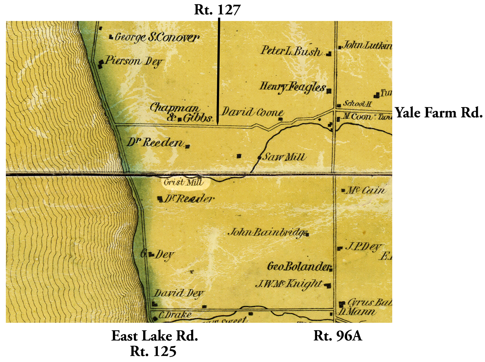 1838 or 1858 Seneca County Var-4 excerpt Map.jpg ¹ 7/31/1964 | 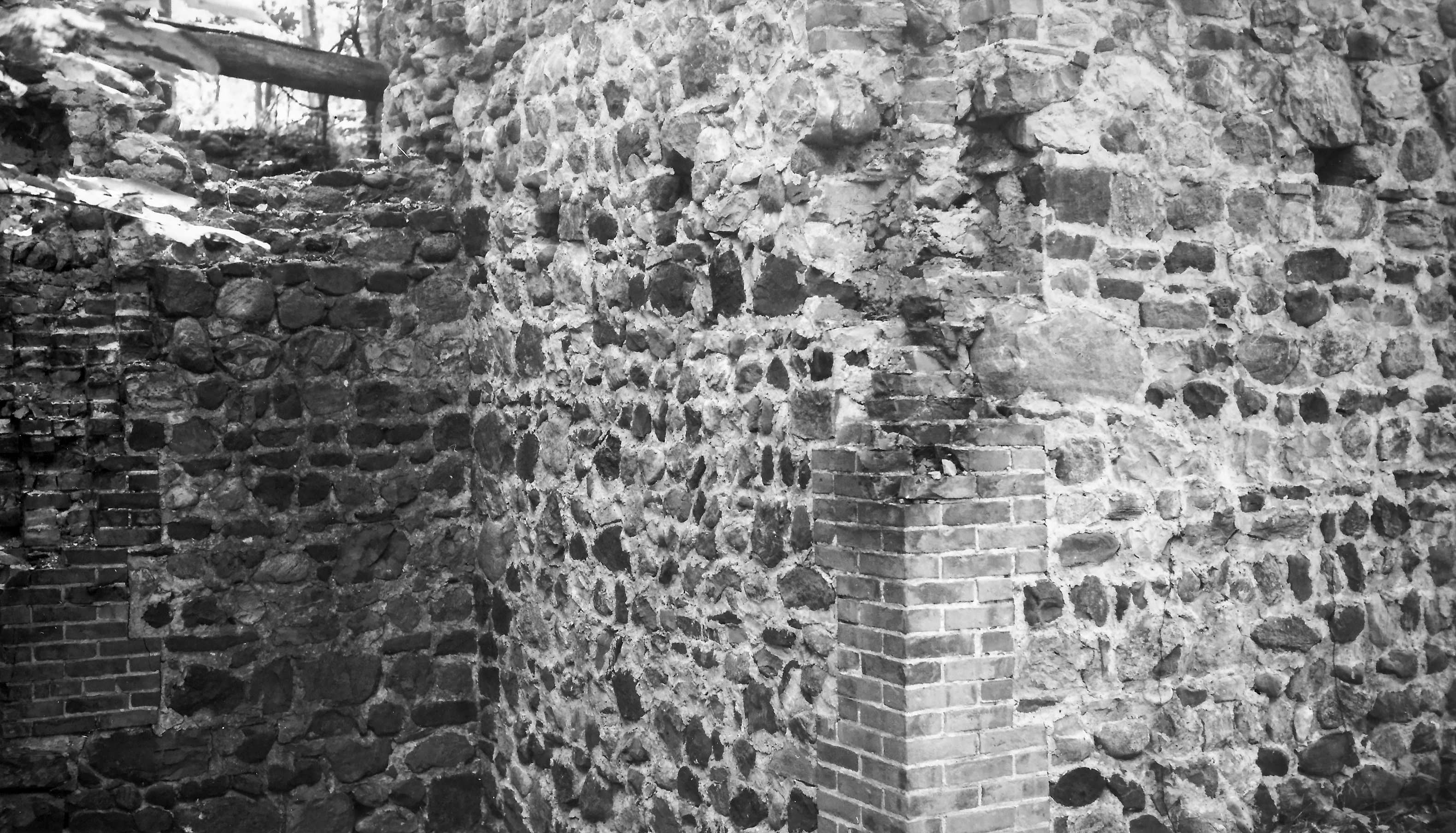 Var-4 Grist Mill Ruins 1.jpg ² 7/31/1964 | 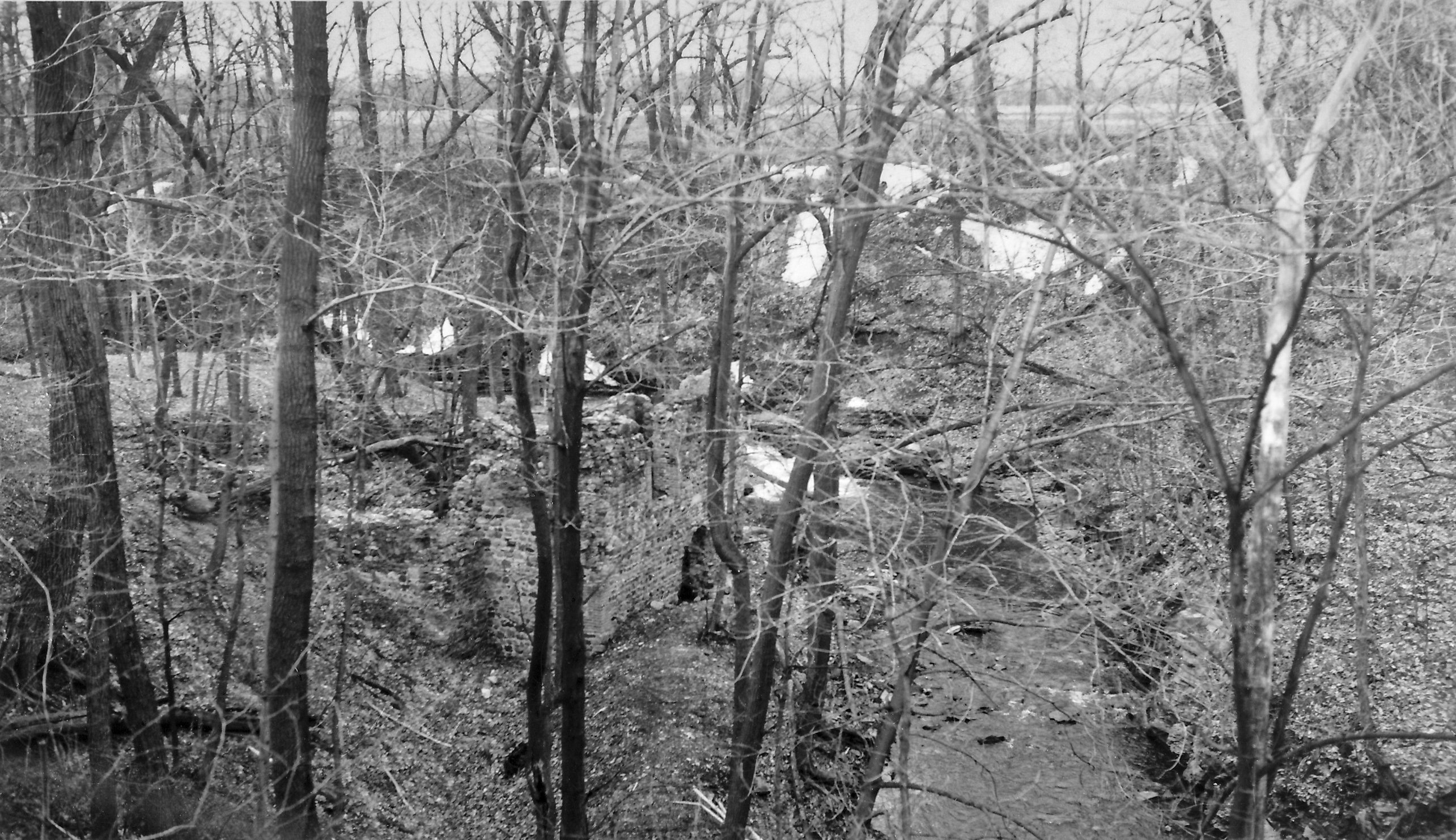 Var-4 Grist Mill Ruins 2.jpg ² 3/8/1964 |  Var-4 Grist Mill Ruins 3.jpg ² 3/8/1964 |
¹ 1838 or 1858? Seneca County Map Var-4 excerpt courtesy Library of Congress. 1838 printed on map, but stated as likely to be 1858 by Library of Congress.
² Image courtesy Cobblestone Museum. 3/8/1964 negatives in Waterloo Historical Society.
